
 |
 |
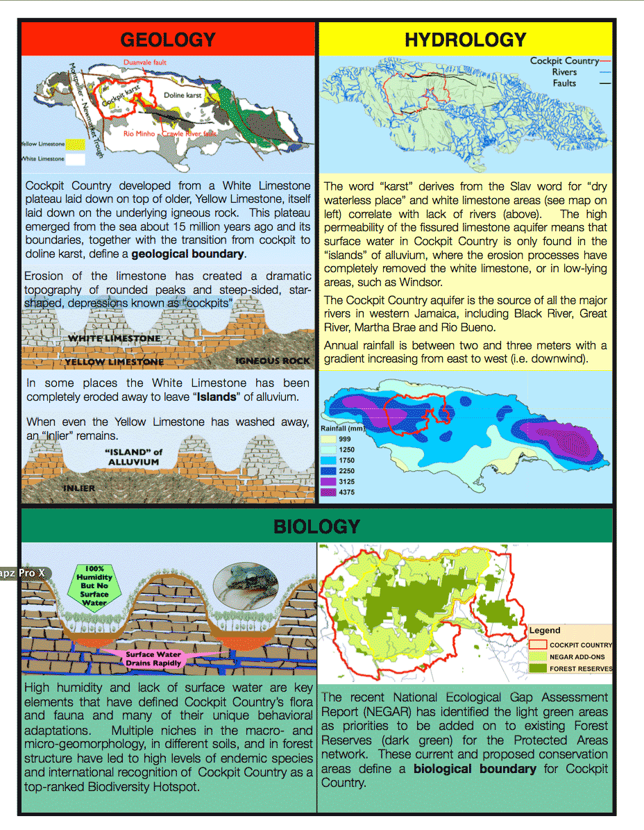 |
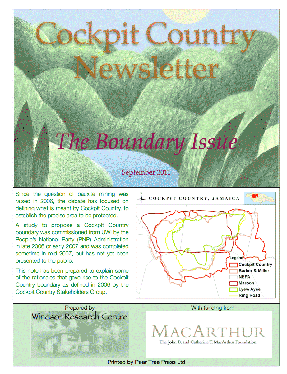
In 2006, using GIS software, we allowed Cockpit Country to define itself. Without assigning any priorities which could lead to bias or exclusions, WRC's geo-database brought together layers of:
We then drew a boundary which enclosed these overlapping features, generally sticking to existing roads (which, themselves, developed becasue cockpit karst morphology and its hydrology greatly influences HOW humans move through the landforms and WHERE they settle to live and grow food). To the best of our knowledge, this was the first time anyone brought together all abiotic and biotic features, to let Cockpit Country define itself.
This boundary, encompassing 116,218 hectares, was recognized by the Cockpit Country Stakeholders Group (CCSG) in November 2006 and presented in early Decemeber 2006 to Dr. Omar Davies in his capacity as Minister of Finance and Planning.